The Cape of Good Hope |
|||||||||||||||||||||
|
|||||||||||||||||||||
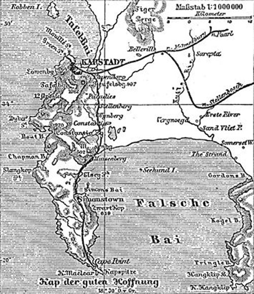
The Cape of Good Hope is a headland in South Africa, near Cape Town, traditionally — and incorrectly — regarded as marking the turning point between the Atlantic Ocean and the Indian Ocean. (Technically, the division between the two oceans lies further south-east at Cape Agulhas) The cold Benguela current on the West coast and the warm Agulhas current merge off the cape of Good Hope, which, along with the nearby Cape Point offers spectacular scenery. |
|||||||||||||||||||||
|
The Cape of Good Hope was first rounded by Portuguese navigator Bartolomeu Dias in 1488, who named it "Cape of Storms" (Cabo das Tormentas). It was later renamed by John II of Portugal as "Cape of Good Hope" (Cabo da Boa Esperança) because of the opening of a route to the east. Dutch merchant Jan van Riebeeck established a resupply camp for the Dutch East India Company near the Cape on April 6, 1652 which eventually developed into Cape Town.
On December 31, 1687 a band of Huguenots were sent to the Cape from the Netherlands. They had escaped to the Netherlands from France in order to flee religious persecution there. The Dutch East India Company needed skilled farmers at the Cape of Good Hope, and the Netherlands Government saw opportunities for the Huguenots at the Cape and sent them over. The United Kingdom on January 19, 1806, occupied the Cape. It was ceded to the UK in the Anglo-Dutch Treaty of 1814 and was henceforth administered as the Cape Colony.
|
||||||||||||||||||||
|
|
|||||||||||||||||||||
| This article is licensed under the GNU Free Documentation License. It uses material from the Wikipedia article "The Cape of Good Hope ". | |||||||||||||||||||||