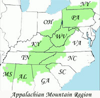
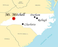
 Mount Mitchell is the highest peak of the Appalachian Mountains and the highest peak in eastern North America, excluding island summits. It was the highest point in any state of the United States until Texas joined the union in 1845. The nearest higher point on the North American continent is Harney Peak in the Black Hills of South Dakota. Mount Mitchell is located near Burnsville in Yancey County, North Carolina, in the Black Mountain subrange of the Appalachians, and about 25 miles north of Asheville. It is protected by Mount Mitchell State Park and surrounded by the Pisgah National Forest. Mount Mitchell is the highest peak of the Appalachian Mountains and the highest peak in eastern North America, excluding island summits. It was the highest point in any state of the United States until Texas joined the union in 1845. The nearest higher point on the North American continent is Harney Peak in the Black Hills of South Dakota. Mount Mitchell is located near Burnsville in Yancey County, North Carolina, in the Black Mountain subrange of the Appalachians, and about 25 miles north of Asheville. It is protected by Mount Mitchell State Park and surrounded by the Pisgah National Forest.

The weather on Mount Mitchell is very mild in the summer and very harsh in the winter, more like Maine or southeastern Canada than the southeastern U.S. In 1985, the coldest temperature ever recorded in the state occurred there on January 21 when it fell to -34°F (-37°C), during a severe cold spell that brought freezing temperatures as far south as Miami. It is also the coldest average reporting station in the state at 43.8°F or 6.6°C which is well below any other station. Unlike the lower elevations in the surrounding regions, heavy snows often fall from December to March, with 50 inches accumulating in the Great Blizzard of 1993. The summit is often windy, with the record being 178 mph.
The high elevations also expose plant life to high levels of pollution, including acid precipitation – rain, snow, and fog with very low pH. These acids damage the spruce and fir trees particularly badly, in part by releasing natural metals from the soil like aluminum, and by leaching important minerals. This stress also reduces the trees' resistance and immunity to insects, especially to non-native introduced pests like the Balsam woolly adelgid.
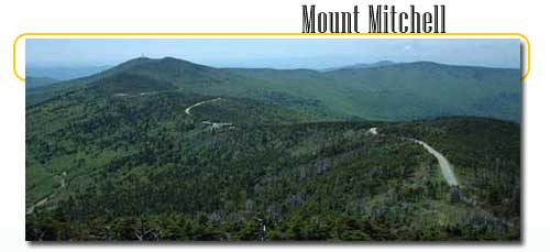
While the mountain is still mostly lush and green in the summer, many dead trunks can be seen due to these serious problems. Repairing the damage is a difficult issue, as the pollutants are often carried in from long distances. Sources can be local or hundreds of miles or kilometers away, requiring cooperation from as far away as the Midwest.

 The mountain was named after Elisha Mitchell, a professor at the University of North Carolina, who determined its height in 1835 and fell to his death at nearby Mitchell Falls in 1857, having returned to verify his earlier measurements. The mountain was named after Elisha Mitchell, a professor at the University of North Carolina, who determined its height in 1835 and fell to his death at nearby Mitchell Falls in 1857, having returned to verify his earlier measurements.

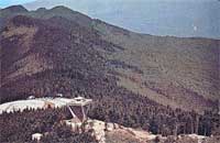
The ascent of Mount Mitchell is now rather easy, since a road off the historic and scenic Blue Ridge Parkway runs nearby, and a 980 ft trail leads through a conifer forest to the top. The summit once featured a 40 ft stone observation tower, which was torn down in late 2006 and is being replaced by a shorter observation platform. Also at the summit is the tomb of Dr. Mitchell.
Still, hundreds of tourists visit the peak each spring through autumn, for its incredible views and sunsets. Wildflowers are abundant all summer long. Young fir and spruce trees do well in the subalpine climate, and their pine cones feed the birds along with wild blueberry and cranberry shrubs. For visitors, a snack bar more palatable for humans is also available at the summit parking lot. |